
EXPLORE
THE ENVIRONMENTS

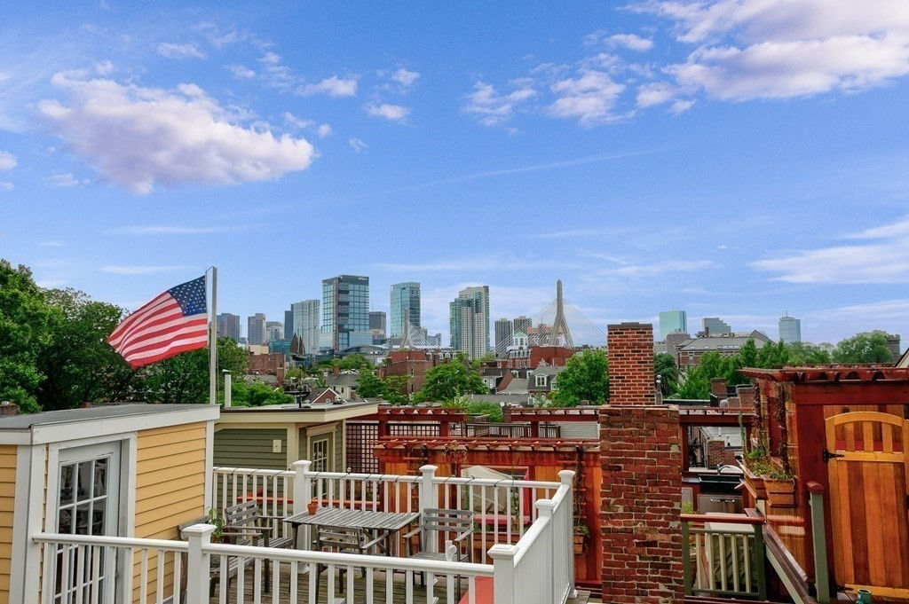
Boston - Back Bay
An iconic neighborhood of Boston, built in the mid-1800’s on reclaimed land in the Charles River basin. Prior to a monumental 19th-century filling project, what is now the Back Bay was a literal bay. Today, along with neighboring Beacon Hill, it is one of Boston's two most expensive residential neighborhoods.
The Neighborhood Association of the Back Bay considers the neighborhood's bounds to be the Charles River on the North; Arlington Street to Park Square on the East; Columbus Avenue to the New York New Haven and Hartford right-of-way (South of Stuart Street and Copley Place), Huntington Avenue, Dalton Street, and the Massachusetts Turnpike on the South; Charlesgate East on the West.
It is famous for its well-preserved Victorian brownstone row houses, considered one of the best-preserved examples of 19th-century urban design in the United States and for numerous architecturally significant buildings such as the Prudential building and John Hancock tower.

Boston - North End
As Boston's oldest residential community since the 1630's, this neighborhood is known as Boston's Little Italy and is a major tourist attraction with many 5-star rated restaurants. With its narrow streets and alleys, there is history around every corner.
The North End has a mixture of architecture from all periods of American history, including early structures such as the Old North Church (1723), the Paul Revere House (1680), the Pierce-Hichborn House (1711), the Clough House (1712) and the Skinny House, the narrowest house in Boston (c. 1857). However, the bulk of the architecture seen in the area today dates from the late 19th to early 20th centuries, when tenement architecture replaced mansions and other buildings to accommodate the influx of immigrants.
The rerouting of the Central Artery I-93 through the heart of the city, replaced the elevated freeway built in the 1950’s with a wonderful stream of parks from North Station all the way to South Station.

Boston - Beacon Hill
Beacon Hill is a historic neighborhood of Boston. It is well known for its Federal-style row houses, gas-lit streets and brick sidewalks and regarded as one of the most desirable and expensive neighborhoods in Boston.
Located just north of Boston Common and the Boston Public Garden, it is bounded by Beacon Street on the south, Somerset Street on the east, Cambridge Street to the north and Storrow Drive along the riverfront of the Charles River Esplanade to the west. The block bounded by Beacon, Tremont and Park Streets is included as well, as is the Boston Common itself.
The level section of the neighborhood west of Charles Street, on landfill, is known locally as the "Flat of the Hill."
Because the Massachusetts State House is in a prominent location at the top of the hill, the term "Beacon Hill" is also often used as a metonym in the local news media to refer to the state government or the legislature.

Boston - West End
The West End is a neighborhood bounded by Cambridge Street to the south, the Charles River to the west and northwest, North Washington Street on the north and northeast, and New Sudbury Street on the east. Beacon Hill is to the south, North Point is across the Charles River to the north, Kendall Square is across the Charles River to the west, and the North End is to the east.
A late 1950s urban renewal project razed a large Italian and Jewish enclave and displaced over 20,000 people in order to redevelop much of the West End and part of the neighboring Downtown.
Years later, the original West End became increasingly non-residential, including part of Government Center (formerly Scollay Square) as well as much of Massachusetts General Hospital and several high rise office buildings. However, more recently, new residential buildings and spaces, as well as new parks, have been appearing across the West End.
Boston - Charlestown
Charlestown is located north of downtown Boston on a peninsula extending southeastward between the Mystic and the Charles Rivers.
Charlestown was laid out in 1629 by engineer Thomas Graves, one of its earliest settlers, during the reign of Charles I of England. It was originally a separate town and the first capital of the Massachusetts Bay Colony.
The oldest neighborhood in the city, it is home to many historic sites along the Boston’s Freedom Trail, such as the Bunker Hill Monument, site of the famous battle during the American Revolution War, the 1780 Warren Tavern, the 1797 USS Constitution, the oldest warship in the world still afloat.
A tight-knit community, the Orange Line train, the Navy Yard Ferry to Long Wharf, its mix of waterfront and historic brick homes on gas-lit streets make Charlestown one of the most sought-after neighborhoods in Boston.

Boston - South End
Listed in the National Register of Historic Places, the South End lies south of Back Bay.
The neighborhood is the largest intact Victorian row-house district in the country, covering over 300 acres. In 1973, the South End was listed on the National Register of Historic Places. Much of the neighborhood was originally marshlands in Boston's South Bay. After it was filled in, construction began in 1849.
It is known to be a culture and arts-friendly diverse neighborhood and is home to the Boston Center for the Arts (BCA), the Boston Ballet, artists' studios and galleries. Its charming mid-nineteenth century architecture features a red-bricked mix of flat and bow-front row houses with cast iron railings and granite trim but also modern lofts appealing to a young professional crowd that loves the eclectic international cuisine variety of the "Restaurant Row" on Tremont Street, the chic urban feel, over thirty parks, and the vibrant nightlife.

Boston -
Allston/Brighton
Located in the western part of Boston, these two adjacent neighborhoods are referred to as Allston–Brighton and have a strong presence of student and young professionals.
The architecture consists of mid-rise brick buildings, primarily along and nearby Commonwealth Avenue, and a mix of 1890-1920s single-family, 2-family and triple-decker multi-families. Brighton also features waterfront properties along the Charles River and includes portions of the Boston College and Boston University, while a substantial part of the Harvard University campus is located in lower Allston, including Harvard Business School and Harvard Stadium.
The Auerbach Center in Brighton is the practice facility for the Boston Celtics in Boston. , the 160,000-square-foot building is part of a larger mixed-use development constructed by New Balance at Boston Landing that includes the headquarters of New Balance and the practice facility of the Boston Bruins next door.

Boston - Seaport
The Seaport District is a neighborhood in Boston. It is part of the larger neighborhood of South Boston, and is also sometimes called the Innovation District. It was a formerly an industrial area that has undergone an extensive redevelopment effort in recent years.
It is bordered by the Fort Point Channel to the west, Boston Harbor to the north and east, and the historic residential neighborhood of South Boston to the south. It is officially referred to by the City of Boston as The South Boston Waterfront.
A $22 Billion Development in the Seaport has boomed following the completion of the "Big Dig". It was considered "the hottest, fastest-growing real estate market in the country" in 2014. As of 2017, it was the fastest growing part of Boston and has stimulated significant economic growth in the city.
Its modern New York style urban feel, chic high-rise condo developments, and classy restaurant scene attracts many young high-earners and tourists.

Brookline
The birthplace and hometown of John F. Kennedy, Brookline borders six Boston's neighborhoods: Brighton, Allston, Fenway–Kenmore, Mission Hill, Jamaica Plain, and West Roxbury. The city of Newton lies to the west of Brookline.
Brookline was known as the hamlet of Muddy River and was considered part of Boston until the Town of Brookline was independently incorporated in 1705.
In Brookline you can find unique and well-preserved examples of nearly every type of building in almost every architectural style. Its cultural hub status, the attractive mix of urban and suburban feel make this town highly sought-after.
Brookline is served by the C and D branches of the MBTA's Green Line trains, with inbound service to downtown Boston and outbound service to Newton. The B line runs along the town's northern border of Commonwealth Avenue in Allston and Brighton.

Newton
The city of Newton is seven miles west of downtown Boston and comprises a patchwork of thirteen villages without a city center.
Newton was originally part of "the newe towne", which was settled in 1630 and renamed Cambridge in 1638. Newton was incorporated as a separate town, known as Cambridge Village in 1681, then renamed Newtown in 1691 and finally Newton in 1766. It became a city in 1874 and is known as The Garden City.
It is bordered by Waltham and Watertown on the north, Needham and Boston - West Roxbury on the south, Wellesley and Weston on the west, and Brookline and Boston - Brighton on the east.
Newton's villages are: Auburndale, Chestnut Hill, Newton Centre, Newton Corner, Newton Highlands, Newton Lower Falls, Newton Upper Falls, (both on the Charles River) Newtonville, Nonantum, Oak Hill, Thompsonville, Waban and West Newton.